Catalog Archive
Auction 127, Lot 785

"Part of the Pacific Ocean between California and the Philippine Islands…", La Perouse, Comte Jean F. Galoup, de

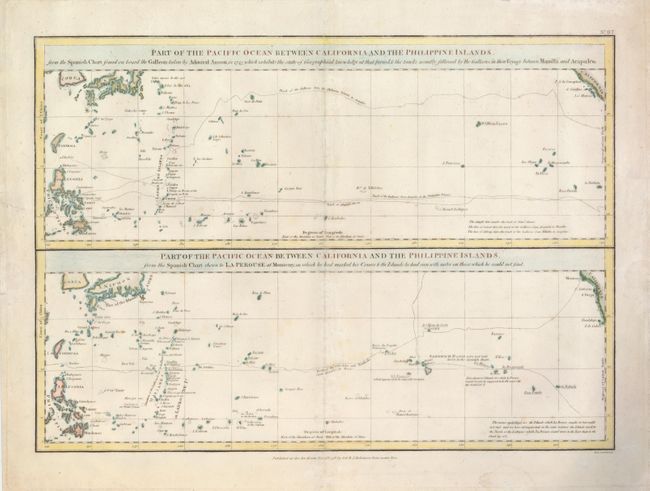
Subject: Pacific Ocean

Period: 1798 (dated)

Publication: A Voyage Round the World

Color: Hand Color

Size:
19 x 13.5 inches
48.3 x 34.3 cm
Download High Resolution Image
(or just click on image to launch the Zoom viewer)

This interesting sheet contains two maps that cover the same area of the central Pacific. The top chart shows the routes of the Spanish galleons from Acapulco to the Philippines along with the track of Commodore Anson. This chart does not show the Hawaiian Islands, as they were unknown to the Spanish. The bottom chart shows La Perouse's route from Monterey, through Hawaii and the Mariannes, to Macao. Engraved by Neele and published by G.G. & J. Robinson in the English edition of La Perouse's voyage.

References:

Condition: B+

There are some faint damp stains in the blank margins and few faint foxing spots in the map.

Estimate: $275 - $350

Sold for: $200

Closed on 2/25/2009

Archived