Catalog Archive
Auction 127, Lot 783

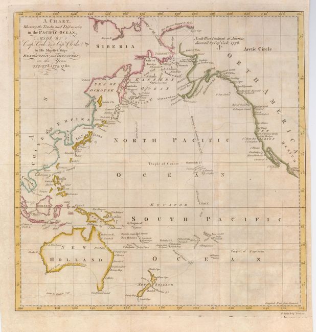
"A Chart, Shewing the Tracks and Discoveries in the Pacific Ocean, Made by Capt. Cook, and Capt. Clerke in his Majesty's Ships Resolution and Discovery, in the Years 1777, 1778, 1779, 1780",

Subject: Pacific Ocean

Period: 1782 (circa)

Publication: An Authentic Narrative of a Voyage Performed by Captain Cook and Captain Clerke

Color: Hand Color

Size:
13.5 x 13.8 inches
34.3 x 35.1 cm
Download High Resolution Image
(or just click on image to launch the Zoom viewer)

This map covers the whole Pacific and focuses on the discoveries of Capt. Cook during his three voyages in the Pacific, in which he charted the eastern coastline of Australia and much of the northwest coast of North America, circumnavigated New Zealand, and discovered numerous Pacific islands including the Hawaiian Islands. The map was included in William Ellis' account of Captain Cook’s third voyage, one of the first privately published works of the historic voyage. Ellis was a surgeon’s mate on the voyage who sold his narrative and drawings to a publisher; thus he ruined his naval career by violating the Admiralty’s injunction against such private endeavors. The map was engraved by Matthew Smith.

References: Howes #E122.

Condition: B

Issued folding. A 1-1/2" binding tear at right has been repaired. The paper is slightly toned.

Estimate: $350 - $450

Sold for: $350

Closed on 2/25/2009

Archived