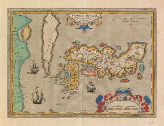
Subject: Japan and Korea
Period: 1595 (dated)
Publication: Theatrum Orbis Terrarum
Color: Hand Color
Size:
19 x 14 inches
48.3 x 35.6 cm
This landmark map was the first map of Japan published in a European atlas. Ortelius received the map from Ludovico Teixeira, a Portuguese Jesuit cartographer and mathematician. While Teixeira had not personally traveled to Japan, he obviously had access to Japanese sources as the map presents the first reasonably accurate and recognizable depiction of the island nation with numerous Japanese place names. Korea appears as an island tapering to a point labeled Punta dos ladrones. The map is elegantly embellished with three large galleons, two elaborate cartouches and a boldly engraved border. This influential map was to become the basis for many other cartographers' maps of Japan for more than fifty years. Latin text on verso, p. 107 indicating it was published in the 1601 edition as the lower left corner of the plate appears undamaged (it was damaged sometime between 1606 and 1608).
References: Walter OAG #5, plt. 19; Van den Broecke #165.
Condition: A
Fine impression and lovely old color. The map is toned on verso with a few short edge tears, not near the map.