Subject: China, Korea & Japan
Period: 1805 (dated)
Publication: A Voyage of Discovery to the North Pacific Ocean
Color: Black & White
Size:
18.5 x 19.3 inches
47 x 49 cm
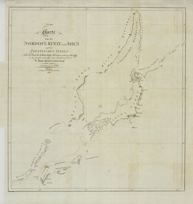
This fine chart stretches from Formosa northward to show much of Japan plus the coastline of Korea and China. The lines of exploration are identified as belonging to the sloop Providence in 1796 or to the schooner in 1797. Prior to this expedition, William Robert Broughton was a lieutenant in the Royal Navy and was part of Vancouver's voyage of exploration in the early 1790s. In 1793, he was promoted to captain and given command of the corvette HMS Providence. Broughton explored Asia and surveyed the coast of Hokkaido before wintering at Macao. It was here that he purchased a small schooner as a back-up vessel. This proved fortunate when the Providence was wrecked at Miyako Island to the south of Okinawa. Broughton continued the exploration of northeast Asia in the schooner, returning home in early 1799. This is from a scarce German edition of Broughton's book.
References:
Condition: B+
Very nice example with crisp impression and full margins. A few spots and a hint of title offsetting below.