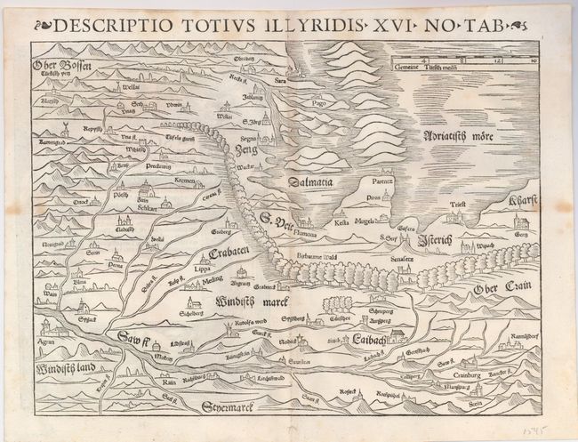
Subject: Balkans
Period: 1552 (circa)
Publication: Geographia
Color: Black & White
Size:
13.5 x 10 inches
34.3 x 25.4 cm
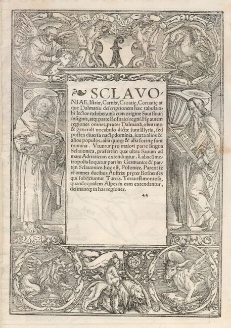
This early map of ancient Illyricum covers the present-day region of Slovenia, Croatia and Bosnia. The map is oriented with south approximately at the top of the map and the Sava River running along the bottom. The coastline is shown between Trieste and Zadar. In the upper left the villages in the Turkish territory (Bosnia) are marked with the crescent symbol. The map scale is expressed in German miles. Elaborate woodcut illustrations surround Latin text on the verso.
References:
Condition: B+
Faint toning along centerfold and a couple minor spots at sides. There is a small binding hole in the bottom margin, not affecting the map.