Catalog Archive
Auction 127, Lot 612

"A New & Accurate Map of the Krim Tartary, the Sea of Azof, and Parts of the Rivers Dneper, Bog and Kuban", Lodge, John

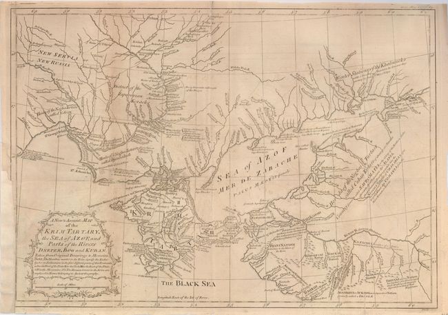
Subject: Ukraine & Black Sea

Period: 1769 (dated)

Publication: Gentleman's Magazine

Color: Black & White

Size:
16.5 x 11.5 inches
41.9 x 29.2 cm
Download High Resolution Image
(or just click on image to launch the Zoom viewer)

This map shows the Ukraine and the Crimean peninsula as well as a small portion of Russia during the period of hostilities between the Turks and Russians, 1768-74. This map proposes a strong disagreement with the accuracy of Andrew Dury's Map of the Seat of War between the Russian, Poles and Turks that was published in the same period. It apparently inflamed this mapmaker enough to write a scathing editorial to Gentleman's Magazine in complaint, accompanied by this "sketch" of his soon-to-be superior map. Published in the August 1769 edition.

References: Jolly GENT-197.

Condition: B

Overall even toning and offsetting visible in blank areas. Issued folding, now backed with archival tissue and paper laid in at binding edge trim

Estimate: $80 - $120

Sold for: $60

Closed on 2/25/2009

Archived