Subject: North Pole
Period: 1649 (published)
Publication: Theatrum Orbis Terrarium
Color: Hand Color
Size:
20.8 x 16 inches
52.8 x 40.6 cm
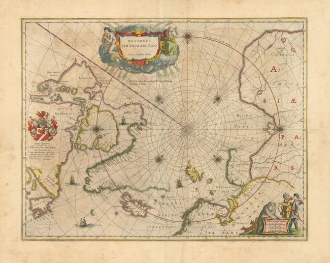
This is an early example of one of the important prototype maps of the Arctic. It incorporates new information from the explorations of Capt. Thomas James with the bay named for him labeled here James his Bay. The Arctic coast of Russia provides information from Willem Barentsz' voyage and Spitsbergen is shown according the Danish expedition of James Hall. Rhumb lines radiate from the North Pole and a large title cartouche, with two figures and numerous wind heads, conveniently hides the northwest coast of America. The map is further decorated with several compass roses, ships and an additional cartouche that features men in parkas, a polar bear and foxes. Dedication to Guilielmo Backer de Corneliis (signed by Joan Blaeu), indicates this issue is from the second state of the plate. Latin text on verso and page 4 C.
References: Burden #252; Goss (Blaeu) #2.
Condition: B
A very nice example that would be fine save for overall toning or foxing and two tiny areas of paper abrasion. Very nice impression and color with wide, original margins. A little miss-folding along centerfold in past, now pressed and nearly invisible.