Subject: Gulf of Mexico and Caribbean
Period: 1780 (dated)
Publication:
Color: Black & White
Size:
36 x 19.3 inches
91.4 x 49 cm
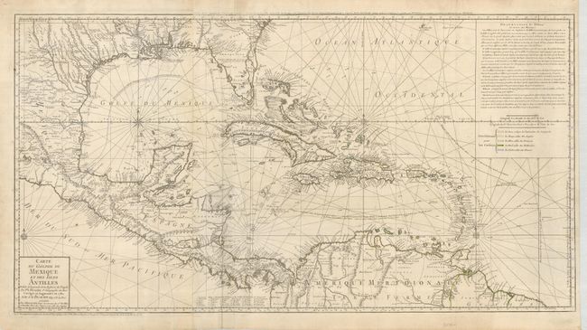
This uncommon map is focused on the Gulf of Mexico and includes the Caribbean Islands, Central America and the northern tip of South America. The map is an updated version of Buache's map of 1740, which itself was based on Henry Popple's important and influential 21-sheet map of 1733. The map shows the variations in the trade winds and includes several navigation routes including the Spanish gold fleet from Vera Cruz to Havana. The entire coastal and interior areas are shown in excellent detail, particularly those of Florida and present-day Texas. The colonial possessions of the region are shown via a color-coded key at the right, beneath a block of explanatory French text. The map is printed on two joined sheets, and is topped with a second title above the neatline; Carte d'une Partie de l'Amerique pour la Navigation…
References: Sellers & Van Ee #1707; Tooley (Amer) p. 29, #92.
Condition: B+
Very nice impression printed on strong paper with original color in outline. The hand color is a little faded or was weakly applied. Soft crease beside centerfold, a couple of edge tears closed on verso, and title above neatline was weakly printed.