Subject: United States, Texas & Mexico
Period: 1840 (circa)
Publication: Black's General Atlas
Color: Hand Color
Size:
14.5 x 10 inches
36.8 x 25.4 cm
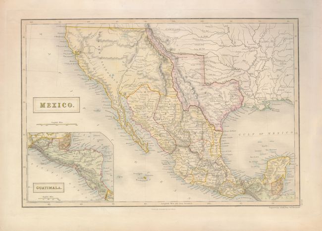
This map covers the present-day Southwestern United States, the Independent Republic of Texas, and Mexico. The map continues into Central America in the inset titled Guatimala. Texas is shown with a stove-pipe panhandle. In Upper or New California, there is an American Fur Company Depot on the eastern shore of L. Youta or Salt L. In New Mexico, the Great Spanish Road is shown from the Red River in Texas to Santa Fe, and then heading south through the length of Mexico. In Mexico all states are delineated and named.
References:
Condition: A
Pleasantly toned with original pastel coloring.