Subject: Arizona
Period: 1901/1906 (dated)
Publication: Department of Interior
Color: Printed Color
Size:
16.8 x 20 inches
42.7 x 50.8 cm
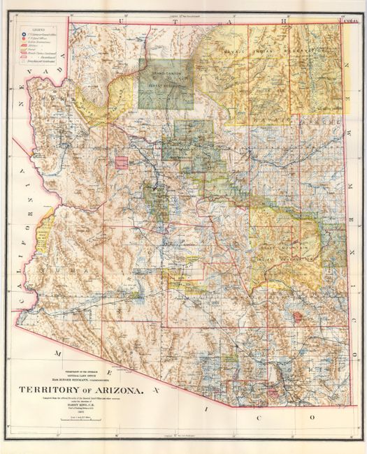
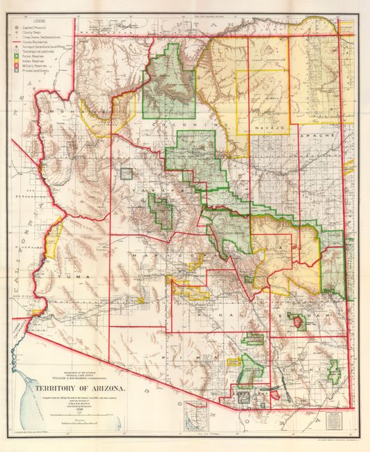
These two colorful maps offer an abundance of detail and show changes in county boundaries, railroads, towns and roads, modifications to Indian Reservation boundaries, resolution of Private Land Grants, etc. Each has a legend in the upper left that explains the use of colors and locates the Surveyor Generals Office, Land Offices, Indian, Military, and Forest Reservations, Private Claims, both confirmed and unconfirmed, townships not Subdivided, Private land grants, and more. The 1901 map was while Harry King was the Chief of Drafting and the Hon. Binger Hermann was commissioner. Frank Bond was the Chief of Drafting and William A. Richards was commissioner in 1906. A fine pair that will reward side-by-side study.
References:
Condition: A+
Both folding as issued. Bright, crisp impressions and fine color. The 1901 map has a closer than normal margin at left, apparently as issued.