Subject: Southwestern United States
Period: 1855 (dated)
Publication: Atlas of the World
Color: Hand Color
Size:
16 x 12.7 inches
40.6 x 32.3 cm
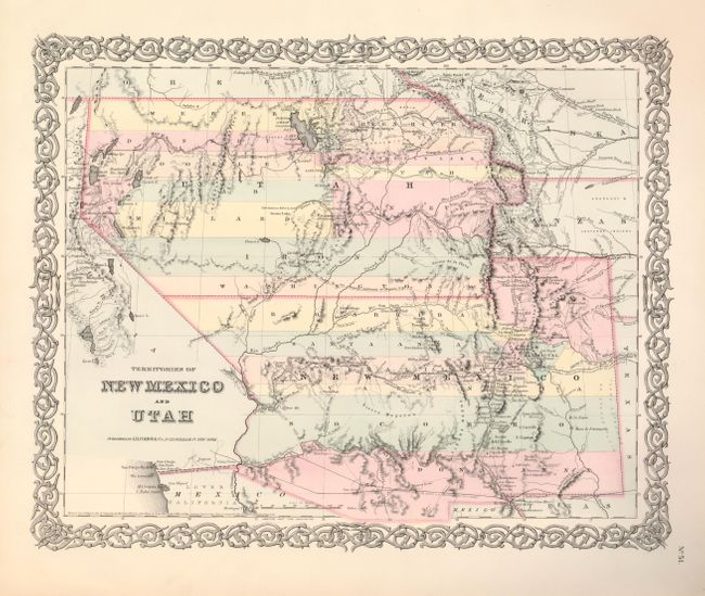
Second state of this very interesting map depicting the region with the largest configurations of the Utah and New Mexico Territories. The Utah Territory encompasses all of today's Nevada and extends west to the Continental Divide into present-day northern Colorado with Fillmore City as its capital. Nebraska and Kanzas Territories bound Utah on the east. New Mexico Territory includes part of southern Colorado and stretches west to include Arizona and the southern tip of present-day Nevada. Locates Fremont's routes, proposed routes for the Pacific Railroad, the Spanish Trail, and much more. A fine example of a very desirable map that Wheat found important enough to use as the frontispiece to Volume 4 of his Mapping the Transmississippi West. The map is enclosed in Colton's distinctive decorative border and was published in 1856.
References: Brown (Portolan - Spring 2005) pp. 48-51; Wheat [TMW] #832.
Condition: A+