Subject: Western United States
Period: 1875 (circa)
Publication:
Color: Black & White
Size:
26.5 x 6.5 inches
67.3 x 16.5 cm
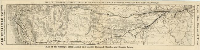
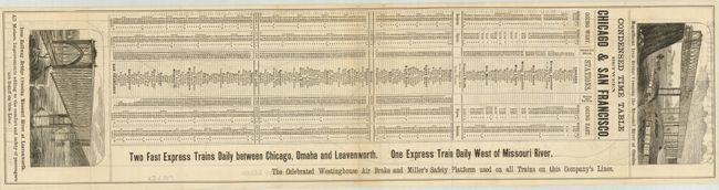
This scarce railroad timetable map shows a strip across the country from Illinois to California. It also details the "Old Reliable Route Between Chicago, Leavenworth and Omaha." The map is unique for its depiction of Bison using scores of small buffalo icons scattered in the mid-west. It depicts mines, roads, forts and towns, rivers and topography. On the verso is the "Condensed Time Table Between Chicago & San Francisco" guaranteeing "Two Fast Express Trains Daily" to Omaha and Leavenworth and one daily west of the Missouri River. Two fine wood engraved views: "Magnificent Iron Bridge Crossing the Missouri River at Omaha" and the second shows the Iron Bridge crossing at Leavenworth. The issue of safely is addressed with "The Celebrated Westinghouse Air Brake and Miller's Safety Platform used on all Trains on this Company's Lines." This undated issue is one we've not previously seen. No references or pricing records located.
References:
Condition: A
Folding as issued. Just a hint of toning near center otherwise fine.