Subject: Western United States
Period: 1872 (circa)
Publication: Lloyd's Atlas of the United States
Color: Hand Color
This lot is from Warner & Beers uncommon series, published by H.H. Lloyd & Company. The maps include:
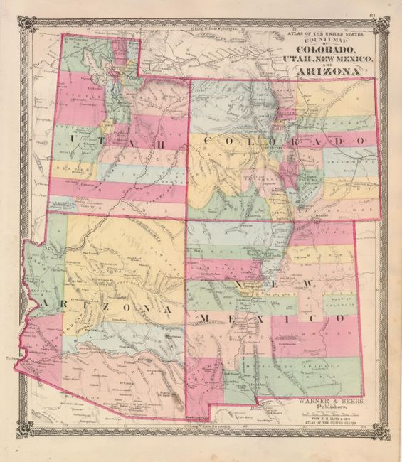
The first map (14 x 16") is centered on the four corners and features early county organization. Arizona has just five counties and locates Maricopas Wells, the future site of Phoenix. Beautifully colored with good detail throughout, the map locates numerous railroads, cities and towns, watershed, forts, etc. There are some early references to mining near Tubac, Arizona and west of the Rockies in Colorado (Oro City). Railroads in an early stage of development, with lines in Colorado and the Transcontinental line delineated in northern Utah. A handsome map with decorative borders and graphic elements at each corner.
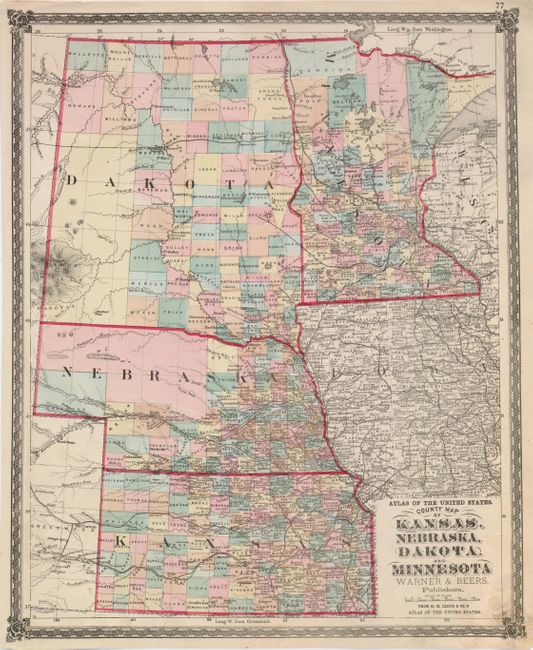
The second map (14.5 x 17.8") shows all of the large Dakota Territory, Minnesota, Nebraska and Kansas. The northwest of Nebraska and southwest of Dakota show no sign of settlement. There is excellent detail of the numerous railroads, plus scores of towns and villages, and watershed. The same decorative border and corner graphics accent this map.
References:
Condition: B+
Both have fine impression and bright original hand coloring. The first is about very good with some marginal soiling in lower margin. The second map is larger so the soiling is in the lower part of the map, good.