Subject: United States - Central and Southwest
Period: 1859 (dated)
Publication: New Universal Atlas
Color: Hand Color
Size:
13 x 16 inches
33 x 40.6 cm
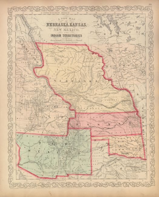
Fine map of the states and territories from this important series of maps originating with Samuel Augustus Mitchell. The map is filled with early county configurations, exploration routes, and various trails including the Santa Fe Trail. Of significance is the delineation of the newly discovered gold fields in western Kansas (Colorado) with Gold Region printed along the Front Range from the South Platte River to the Arkansas River. Nebraska extends between Canada and Kansas, with Washington to the west and Minnesota in the east. Oklahoma is Indian Territory. New Mexico Territory extends from California to Texas and features the northern county of Taos that extends into the future Colorado. Part of Utah Territory is shown and extends to Middle Park and Long's Peak in present-day Colorado with its eastern border formed by Nebraska and Kansas. Interesting features and notations include "Great Indian Treaty Ground", "Uninhabited Region", etc. Desilver's unique scroll border, with his imprint at Philadelphia.
References:
Condition: A
Fine impression and original color on a sheet with lovely ivory age toning and full margins. A little marginal toning, otherwise fine.