Subject: Colonial New England and Mid-Atlantic
Period: 1647 (circa)
Publication: Nouvel Atlas
Color: Hand Color
Size:
19.7 x 15.2 inches
50 x 38.6 cm
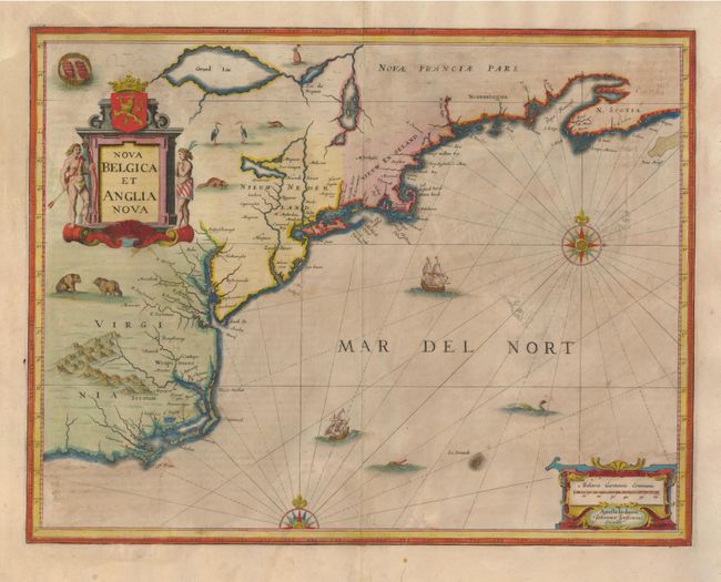
Jansson's influential map of the eastern coast of North America was first issued in 1636 with a less decorative title cartouche. It is derived from the less well know map of Johannes de Laet of 1630, which is generally regarded as the source map for New England and the Northeast. It includes several very early depictions of colonial settlement including Manhattan and the Dutch colony of New Amsterdam, the Nordt Rivier (Hudson) and Zuydt Rivier (Delaware), along with Massachusetts and the English colony at Plymouth. The map includes part of the Great Lakes labeled Grand Lac and Lac des Yroquois, an unnamed Lake Champlain, and a fictitious lake at the headwaters of the Delaware River. This is the second state with the alternate title, giving greater prominence to the Dutch colonies, and with the addition of wildlife throughout the interior. It is beautifully adorned with cartouches, ships, sea monsters and compass roses. Latin text on verso.
References: Burden #247; McCorkle #636.2.
Condition: B
Fine old color highlighted in gold. There are a couple of expert tissue repairs on some minor oxidation that has cracked the paper in a couple of places. There are also a couple of thin spots in the paper, not noticeable unless the map is help up to the light.