Subject: United States
Period: 1894 (published)
Publication: Report of the Eleventh Census of the United States
Color: Printed Color
Size:
33 x 21 inches
83.8 x 53.3 cm
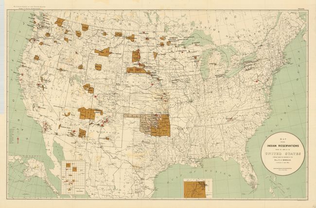
This over-sized map of the United States focuses on the large number of Indian Reservations that existed in 1894. The reservations are named and shown in dark brown overprinting. Inset maps are used where the reservation concentration prevents them showing well on the large map. Insets include Indian Territory and the Mission Indian Reservations in California. A third inset is of the Territory of Alaska. Extensive legend locates Military Stations, Capitals, County Seats, railroads, Indian Agencies, Training Schools, Boarding Schools, Day Schools and Contract Schools. Printed by Sackett & Wilheims Litho Co., New York. A large and very detailed map that is literally filled with information.
References:
Condition: A
A nice example that would be fine except for very light offsetting from the darkly colored reservations and a short tear at binding trim. Beautiful impression and coloring on clean paper with original margins. Folding, as issued.