Subject: Canada and Alaska
Period: 1820 (circa)
Publication:
Color: Hand Color
Size:
10 x 8.2 inches
25.4 x 20.8 cm
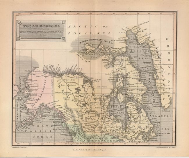
Nice steel engraved map of Canada and Alaska as Russian America, includes Baffin's Bay and part of Greenland. The far north regions are indistinctly mapped. Bank's Land is shown as a blank area with a short shoreline below the North Georgian Islands. Another large blank area begins in central Canada and merges with Bank's Land. A large number of place names are given above 70° North. In the Yukon region are the Dog Rib Indians and to the north are the Mountain, Hare and Copper Indians. Frontier forts include Fort Good Hope and Enterprise Fort. Drawn by J. Assheton and engraved on steel by J. Shury.
References:
Condition: A
A little marginal toning, otherwise fine.