Subject: Canada & United States
Period: 1860 (circa)
Publication:
Color: Hand Color
A pair of German maps dissected in four parts and mounted on original linen. Both are very detailed and include a color key distinguishing the states and territories.
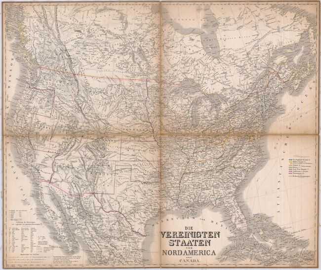
1) Die Vereinigten Staaten von Nordamerica… covers all of the United States, most of Canada, and a little bit of Mexico. There are several large territories in the western United States; many with provisional and/or spurious boundaries. The region of Montana and Wyoming is labeled Chippewa Terr.. Washington wraps around Oregon and takes in most of what would become Idaho. There is a large Dacota Territory. Nebraska is lacking its panhandle. Nevada Territory is sandwiched between an enlarged Utah Territory and a very misshapen California, reflecting a failed territorial configuration that would have taken land from California on the eastern side of the Sierra Nevada mountains. Arizona Territory is too large due to a misplaced eastern boundary with New Mexico (25 x 21").
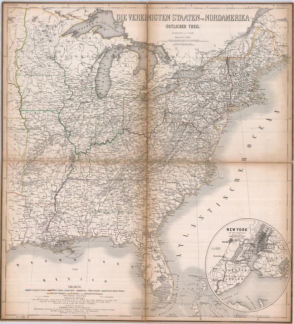
2) Die Vereinigten Staaten von Nordamerika (Ostlicher Theil). This map of the eastern states shows great detail of the cities, roads, railways and topographical features. A large oval inset of the vicinity of New York City and environs fills the Atlantic just above the Bahamas (22 x 24").
References:
Condition: B
Toned at edges and along folds with minor separation of linen at fold intersections.