Subject: Colonial North America and Caribbean
Period: 1740 (circa)
Publication:
Color: Hand Color
Size:
22 x 19 inches
55.9 x 48.3 cm
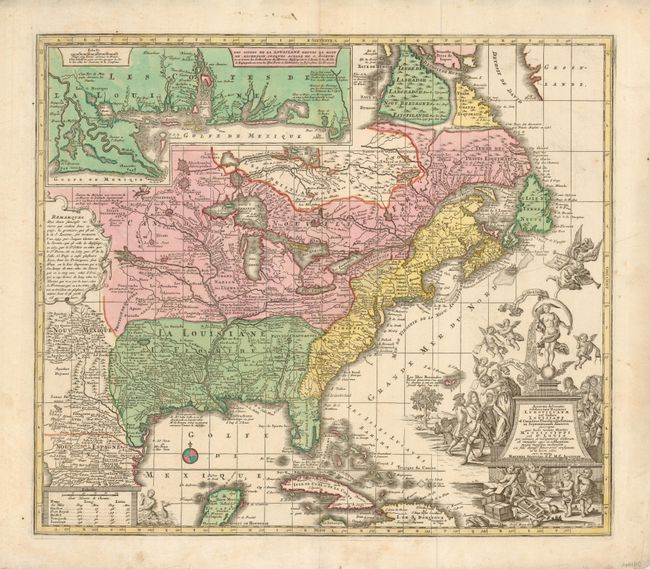
This bold map of the eastern part of North America focuses on the Mississippi River and the Great Lakes. Like many maps of the period, Labrador and Baffin Island are rather confused. A large inset of the Gulf Coast shows many forts and Indian villages. The most interesting feature of the map is the elaborate title cartouche. It depicts an allegorical, satirical scene of the infamous Mississippi Bubble investment scheme with a female personification of Fortuna pouring jewels and riches forth, while she is perched precariously upon a ball, signifying the uncertainty of fortune. Cherubs above the cartouche are issuing stock for the company, and another group is blowing bubbles in the foreground surrounded by piles of worthless stocks. In the background, desperate investors climb a small tree and fling themselves out of it, and in the foreground more disconsolate investors wail and bemoan their fates as one tries to impale himself on his sword. Above them, a cherub upends an empty money-bag.
References: Portinaro & Knirsch #117.
Condition: A
Map image is near fine with strong impression and full coloring. The margins have a couple spots and a few short tears in left margin, one about 1.5" long, all clean. Some occasional roughness to paper edge.