Subject: Canada, Quebec
Period: 1757 (circa)
Publication: Prevost's Histoire Generale des Voyages
Color: Black & White
Size:
11 x 7.5 inches
27.9 x 19.1 cm
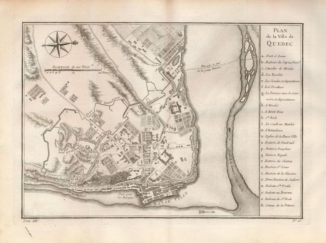
This attractive and informative map of Quebec presents the city as it would have appeared when the French surrendered at the end of the French and Indian War. It is based on earlier plans by Bellin, first published in 1744, that continued to be the definitive view for many years. The list at right keys and names 25 buildings, batteries, forts, and more. This terrific plan of Quebec is oriented with north to the right as indicated by a decorative compass rose and fleur-de-lys. The river is fully engraved in stipple. Below lower neatline "Tom XIM. No. 16."
References: Kershaw #1054.
Condition: A+
A lovely example on thick hand laid paper with good impression. A small line of printer's ink in lower left margin, still fine.