Catalog Archive
Auction 127, Lot 105

"Carte Generale de l'Amerique Septentrionale avec les Possessions Angloises dans cette partie du nouveau monde, Dresse sur la carte de Pople, publiee a Londres en 20 feuilles, pour servir a l'intelligence de la Guerre Presente.", Crepy, (Family)

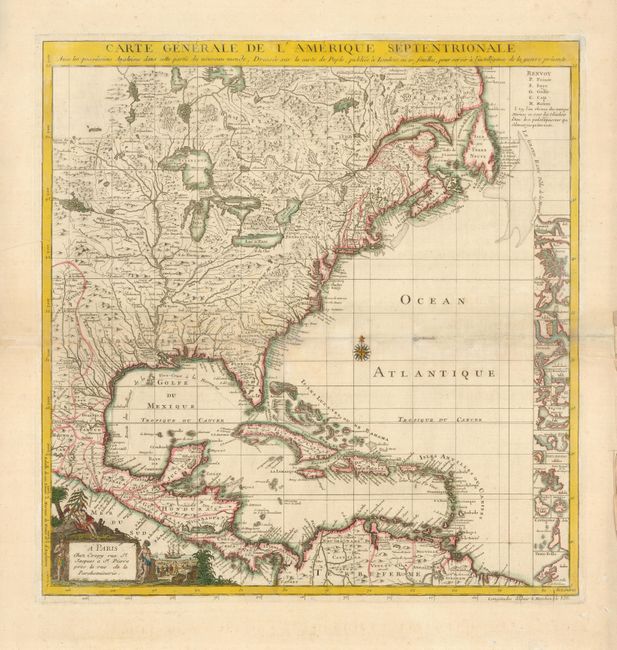
Subject: Colonial North America and Caribbean

Period: 1756 (circa)

Publication:

Color: Hand Color

Size:
19 x 20 inches
48.3 x 50.8 cm
Download High Resolution Image
(or just click on image to launch the Zoom viewer)

This is the French edition of Popple's key map of 1733, made as an index to his 20-sheet map. This map was initially published separately by Le Rouge in 1742; this edition was made after the Crepy family acquired the plate. The title was changed to reflect the outbreak of the French-Indian War, which occurred in 1756. The map is well-detailed, with excellent representations of topography and waterways, particularly the Mississippi. However, there is a large and spurious lake that is connected to a tributary of the river. The right side of the map is filled with small inset maps of important cities in the Americas, including Boston, New York, Charleston, St. Augustine, Port Royal, Cartagena, and Porto Bello. A decorative cartouche, describing natives and trading occupies the lower left corner.

References: McCorkle #742.2.

Condition: B+

There is faint toning along the centerfold with repairs on the verso and a few light stains.

Estimate: $1,100 - $1,300

Sold for: $1,200

Closed on 2/25/2009

Archived