Subject: North America
Period: 1779 (circa)
Publication: Moore's New and Complete Collection of Voyages and Travels
Color: Black & White
Size:
14.8 x 13 inches
37.6 x 33 cm
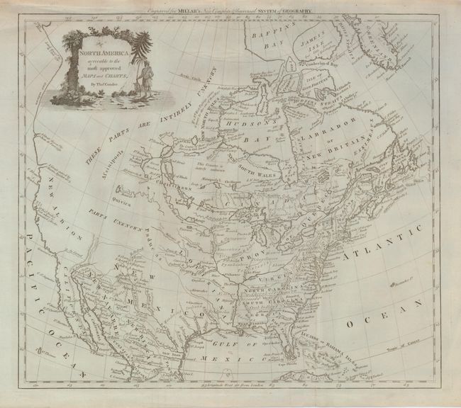
A Revolutionary War era map shows early colonial boundaries and much interesting cartography. The Carolinas, Virginia and West Florida all extend to the Mississippi River. The Red River of the North, R. Rouge, is shown correctly flowing from Lake Winnipeg, but connected a little too directly to the Mississippi River. The western part of the continent is described as both Parts Unknown and Intirely Unknown. The West Coast shows the straits of both Juan de Fuca and Martin Aguilar, in addition to the port of San Francisco, noting that Sir Francis Drake spent five weeks there. The interest in a Northwest Passage via Hudson Bay is evident by the notes surrounding the region, including an assertion that If a West Passage exists it must be thro one of these Bays. An engrossing and uncommon map.
References:
Condition: B+
This stunning example would be graded fine except for some edge splits which have been closed on verso with archival tissue, and a few insignificant printer's creases. The impression is fine and presents beautifully on the blue-toned paper. In the original uncolored state.