Subject: East Indies - Indonesia
Period: 1770 (circa)
Publication: Atlas moderne ou collection de cartes…
Color: Hand Color
Size:
16 x 11.3 inches
40.6 x 28.7 cm
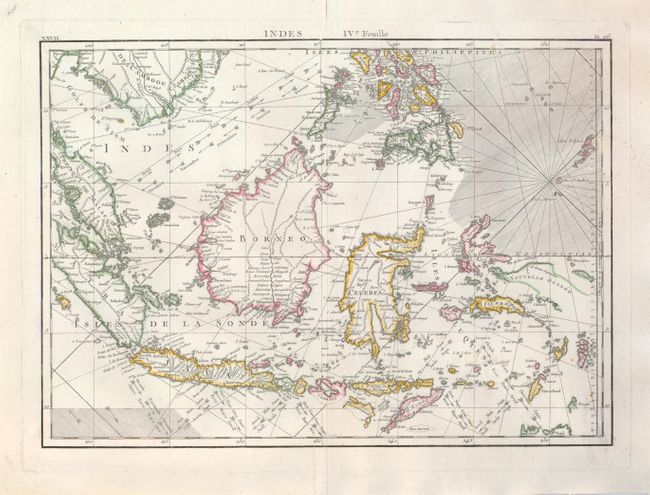
This great chart of the East Indies focuses on the islands of Java, Sumatra, Celebes, Borneo, and the lesser islands of the archipelago. The northern tip of Australia is shown at lower right and a small portion of Nouvelle Guinee is shown in the east. The map is centered on the huge island of Borneo and locates scores of smaller islands, portions of Malacca (Malaysia), Cambodia and the Philippines. The map is embellished with rhumblines and trade wind arrows. This is Bonne's larger and less common chart of the region. Title above upper neatline.
References:
Condition: A+
Fine impression and beautiful hand coloring. On a sheet of thick hand laid paper with wide margins and letter-style watermark.