Catalog Archive
Auction 126, Lot 725

"Plan de Bombay et de ses Environs Tire de Thornton Hyd. Ang.", Bellin, Jacques Nicolas
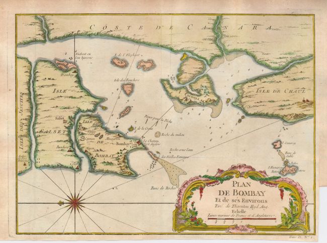
Subject: India

Period: 1751 (circa)

Publication: Prevost's Histoire Generale des Voyages

Color: Hand Color

Size:
10.3 x 7.5 inches
26.2 x 19.1 cm
Download High Resolution Image
(or just click on image to launch the Zoom viewer)

Charming map of the Bay of Bombay showing soundings, anchorages and fortifications. The map is based on the work of John Thornton, hydrographer of the British East India Company (1669-1701). Nicely engraved to show topography and decorated with a French style title cartouche and compass rose, which orients the map with north to the left.

References:

Condition: A

Issued folding, now flattened. Pleasantly toned, with lovely color. Binding trim in right margin, leaving adequate margin for framing.

Estimate: $100 - $150

Sold for: $140

Closed on 12/3/2008

Archived