Catalog Archive
Auction 126, Lot 699

"Tab. V. Asiae, repraesentans Mediam Hyrcaniam, Assyriam, Susianam, ac Persidem", Ptolemy/Mercator

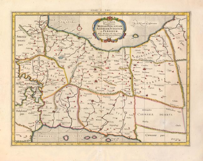
Subject: Persia - Iran

Period: 1695 (published)

Publication: Claudii Ptolemaei's Atlas Tabulae geographicae Orbis Terrarum

Color: Hand Color

Size:
18 x 13.5 inches
45.7 x 34.3 cm
Download High Resolution Image
(or just click on image to launch the Zoom viewer)

Fine Ptolemaic map depicting much of modern-day Iran, Iraq and part of Armenia. The map stretches from the Persian Gulf to the Caspian Sea and features Babylon (Baghdad), the Tigris and Euphrates Rivers. Mercator originally published this map in his 1578 edition of Ptolemy's great Geography. Although he is most renowned today for the projection he popularized and for first using the term Atlas for a collection of maps, he devoted much of his life to his Ptolemaic maps. The maps were beautifully engraved as nearly as possible to their original form and embellished with fine cartouches and pictorial topography.

References:

Condition: B+

Fine impression and lovely color with a couple insignificant spots, mostly in the wide blank margins.

Estimate: $300 - $350

Unsold

Closed on 12/3/2008

Archived