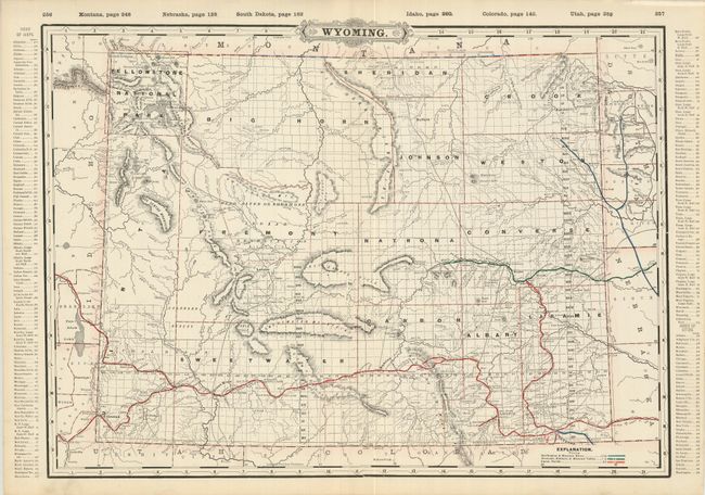
Subject: Wyoming
Period: 1891 (published)
Publication: Standard Atlas of the World and Railroad and Business Atlas
Color: Printed Color
Size:
22 x 16.3 inches
55.9 x 41.4 cm
A large, double-page map from the Railway Atlas with colors detailing the routes of three railroad lines. The map provides an interesting view of Wyoming during this period of mineral exploration and development. The vast coal regions near Green River are noted. It is filled with information and details including towns and settlements, roads and railroads, and the survey progress. It contains particularly good railroad data and an excellent representation of the small post offices. This map was first published in the 1887 atlas, with revisions appearing each year until at least 1907. On this edition Bighorn and Weston counties make their appearance. There is a new rail station and track at Hanna, additional railroad track to the Merino station in Dakota, and the deletion of the station at Wright's Ranch on the track to Idaho. Green River City is now simply Green River, and Franc, Prospect and Milton post offices have been deleted. An index runs along both side borders. On the verso is the "Index to State Map of Wyoming" -- railroads, counties (13 plus the National Park Reservation), and a comprehensive list of towns with their population and index to map. Also on verso is a city map of Cincinnati.
References: Blevins #605.
Condition: A+