Subject: Virginia, Norfolk
Period: 1872 (dated)
Publication: Norfolk City Directory, 1872
Color: Hand Color
Size:
20 x 17 inches
50.8 x 43.2 cm
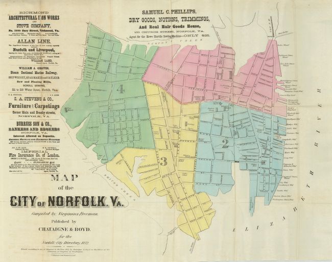
This rare advertising city plan was compiled by Virginius Freeman and published by Chataigne & Boyd. The plan shows all of the town as bounded by Smith's Creek, Newton's Creek, and the Elizabeth River. All streets are named with most still matching the town today. North is oriented to the left but this is not indicated on the sheet. The large number of wharfs along the Elizabeth River are individually named. Today the wharf area is replaced by the Town Point Park, The Waterside, and Harbor Park Stadium. The Academy on Bank Street, the Custom House, Atlantic Hotel, National Hotel, and many more are located. There are text advertisements for the Imperial Fire Insurance Co. of London; the Allan Line Norfolk and Liverpool Steamers; and several more. Lithographed by J.L. Kervand, Washington. During the Civil War, Freeman was a naval engineer with the U.S. Navy. He later was the engineer and acting superintendent of operations for the Norfolk & Virginia Beach Railroad.
References:
Condition: B+
Folding as issued on fine banknote-quality paper. The majority of the map is fine less a split on a fold at upper left with slight loss.