Subject: Texas
Period: 1857-1902 (published)
Publication:
Color: Printed Color
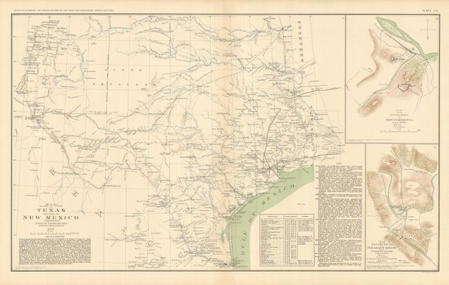
A nice Texas lot. 1) From the "Atlas to Accompany the Official Records of the Union and Confederate Armies", (27.3 x 16.3"). The map is dated 1857 but was actually published decades later in 1892. The authorities referenced to create this map in 1857 are staggering: Ranging from De Cordoba's Map of Texas to over a dozen military surveys and reconnaissances by such luminaries as Whipple, Abert, Emory and Kern. Excellent detail of wagon roads and trails, villages and towns, watershed, forts and much more. The map extends to the valley of the Rio Grande in New Mexico Territory to show Santa Fe and Albuquerque. A fine example with just a trace of edge toning at top (A+).
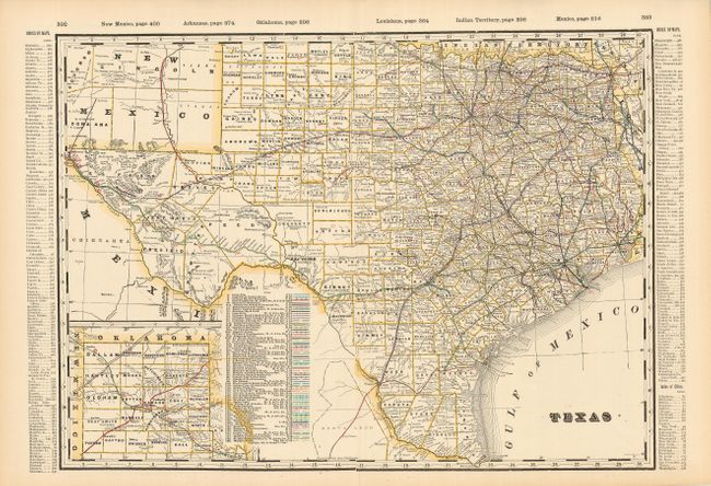
2) From Cram's Business Atlas, 1902, (22.3 x 16.5"). Complete county and town index on verso. This is a very finely printed and colored county map of Texas. More than 70 railroads are keyed with various colored line styles. The panhandle is in an inset on the same scale at lower left. County development matches 1902. Fine example with just a little edge toning (A+).
References:
Condition:
See individual descriptions.