Subject: Texas
Period: 1849 (dated)
Publication: Senate Doc #64 31st Congress, 1st Session
Color: Hand Color
Size:
36 x 24 inches
91.4 x 61 cm
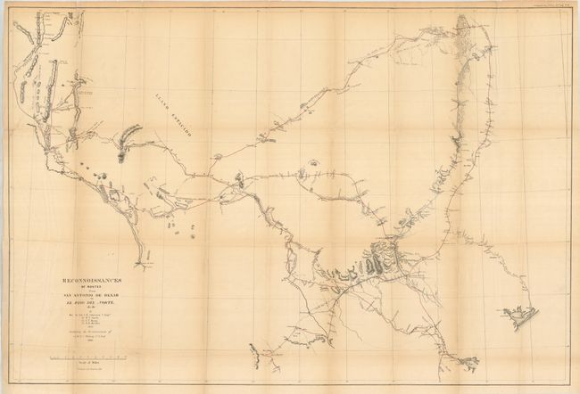
This map covers the region of Texas between the Rio Grande at left and east to include Matagorda Bay, Preston and Fort Washita. There is good detail along routes, especially around San Antonio de Bexar, and mostly blank elsewhere. Shows a reconnaissance of 1849 in red and Lt. Whiting's route in blue. It is filled with geographical information, forts, presidios, springs, fords, watering holes and much more. A fascinating and historical map which is mostly uncolored save for fine coloring along the routes.
References: Wheat (TMW) #677.
Condition: B+
Folding as issued with closed binding trim tear. Light toning on folds. Most fold intersections with splits are reinforced on verso. Margins are sound with no chipping.