Catalog Archive
Auction 126, Lot 322

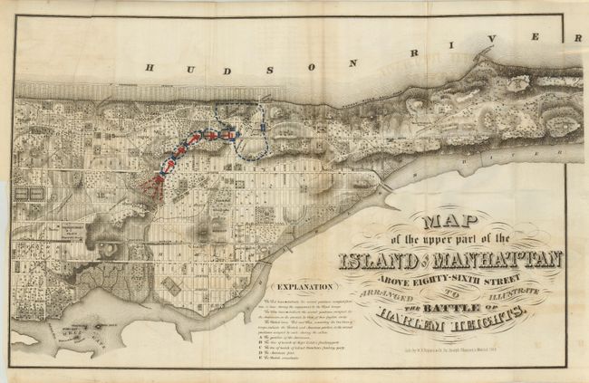
"Map of the Upper Part of the Island of Manhattan Above Eighty-Sixth Street Arranged to Illustrate the Battle of Harlem Heights", Rogers & Shannon

Subject: New York City

Period: 1868 (dated)

Publication: Manual of the Corporation of the City of New York

Color: Printed Color

Size:
23.5 x 14.6 inches
59.7 x 37.1 cm
Download High Resolution Image
(or just click on image to launch the Zoom viewer)

Historical map showing the Revolutionary War battle in detail. The map covers Manhattan from Manhattan Square north to Port Washington Point and Fort George. The positions of the Americans, the British Assailants, and the flanking parties of Major Leitch's and Colonel Knowlton are shown with letters. The detailed troop positions and movements are shown through blue and red block-printed color. Very detailed map of a relatively undeveloped Upper Manhattan with fancy Victorian titling.

References:

Condition: B

Folded as issued. There is some light offsetting and a small fold intersection split. Margin trimmed for binding at left with a 3" binding tear closed with archival tape on verso, small wormhole, fold tear

Estimate: $140 - $180

Unsold

Closed on 12/3/2008

Archived