Subject: New York
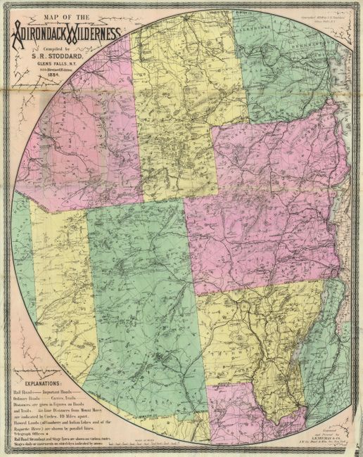
Period: 1884 (dated)
Publication:
Color: Hand Color
Size:
24.5 x 31.3 inches
62.2 x 79.5 cm
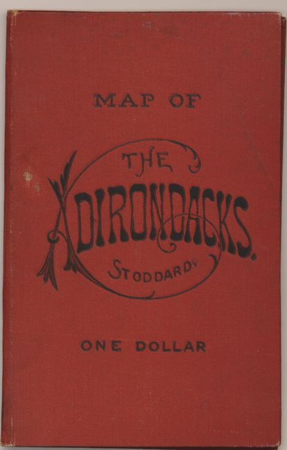
This is an early example of Stoddard's famous and popular Adirondack pocket map, first published in 1880 and revised annually into the first decade of the 20th century. This finely engraved map extends from the eastern edge of Lewis, Croghan, Watson, and Greig counties all the way to Lake Champlain in the east, south to show part of Saratoga and Fulton counties, and north to include Franklin, Clinton and Lawrence counties. The map has good detail throughout including political boundaries, towns and villages, roads, railroads, lakes, watershed, and topography. This edition includes "Rail Road Steamboat and Stage fares…on various routes" printed beside each route. The map is bounded by a partial circle that also notes the destination of the major rivers. The map folds into 4.3" x 7" stamped orange cloth covers. Engraved and printed by L.E. Neuman, & Co., of New York City. Surrounded by decorative border, blank on verso. Blank paste-down on front inside cover.
References:
Condition: B+
The map is perfect with strong, dark impression and beautiful original color less one portion of a fold with split and toning. Also at lower right corner is a printers error with a strip of unprinted area, not affecting map image. Covers are also near fine less two spots and an old owner signature on front pastedown.