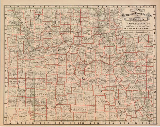
Subject: Missouri
Period: 1879 (dated)
Publication: Cram's Standard American Atlas of the United States
Color: Hand Color
Size:
20.8 x 16.3 inches
52.8 x 41.4 cm
Rare map from the first edition of Cram's most celebrated atlas. The map is highly detailed with hudreds of placenames, all counties, watershed and more. The map extends to show a narrow strip of Kansas with an inset below detailing the boot of Missouri. The extensive railway system centers on St. Louis and spreads in all directions. Also included is a large portion of western Illinois, also detailed and hand colored. The map carries the date of 1879 with a copyright date of 1878. The imprint is Cram's Western Map Depot, 66 Lake St. Chicago, Ills. There was a close relationship between the Cram and Watson firms, who also published from this address. This Lake Street address was the home to Cram's publishing company between 1873 and 1879, thereafter moving to Wabash Avenue.
References: Chicago Map Makers: "George F. Cram and the American Perception of Space" Gerald A. Danzer
Condition: A
Fine original coloring with strong impression.