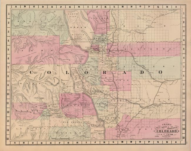
Subject: Colorado
Period: 1879 (dated)
Publication: Cram's Standard American Atlas of the United States
Color: Hand Color
Size:
20.6 x 16 inches
52.3 x 40.6 cm
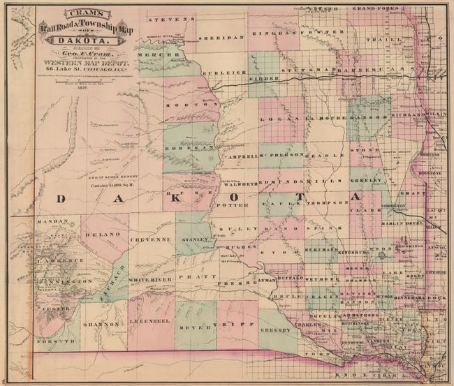
Rare map from the first edition of Cram's most celebrated atlas. The map features early county development to 1877. Not shown is Chaffee County which was orginazed in 1879. Filled with many interesting city and placenames including the mining areas. The railway system is surprisingly well developed; all main railways are named with spurs extending to Alamosa, Leadville, Georgetown, Central City and Boulder City. The fine "Cram's Railroad & Township Map of Dakota" is on verso. The map carries the date of 1879 with a copyright date of 1878. The imprint is Cram's Western Map Depot, 66 Lake St. Chicago, Ills. There was a close relationship between the Cram and Watson firms, who also published from this address. This Lake Street address was the home to Cram's publishing company between 1873 and 1879, thereafter moving to Wabash Avenue.
References: Chicago Map Makers: "George F. Cram and the American Perception of Space" Gerald A. Danzer
Condition: A+
Very fine coloring and impression with original margins. Short marginal tear expertly closed, still fine.