Subject: Colorado
Period: 1873 (published)
Publication: Mission of the North American People
Color: Hand Color
Size:
21 x 20.3 inches
53.3 x 51.6 cm
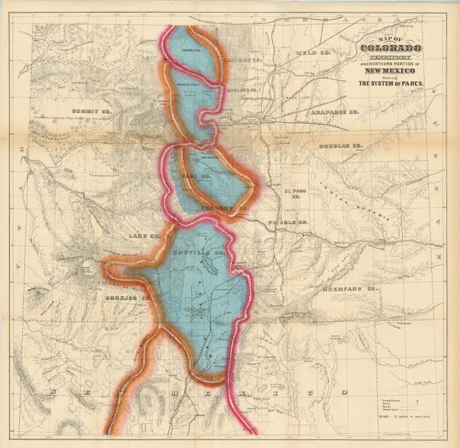
William Gilpin was the first governor of the State of Colorado and a proponent of Manifest Destiny and the transcontinental railway. The map is based on a similar map issued by Jacob Monk in 1865 and covers all of Colorado and part of northern New Mexico. It illustrates the continental divide and four major Parcs; North, Middle, South and San Luis [Valley]. Lesser parks are also noted, as are the status of public land surveys, military posts, mines, and towns. Locates the Denver and Rio Grande, Joseph & Denver, Kansas Pacific, Leavenworth & Denver, Union Pacific, and Denver Pacific railroads, plus a few others. A fascinating map that belongs in any Colorado collection. Printed by the J.B. Lippincott company. A scarce issue.
References:
Condition: A
The map has a fine impression and strong color with original margins. Trace of toning along two folds, still very good.