Subject: California, Yosemite National Park
Period: 1899-1905 (dated)
Publication:
Color: Printed Color
This is a great lot of Yosemite and Sequoia interest. Contains the following maps:
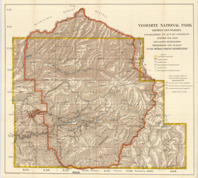
1) Yosemite National Park Showing Boundaries Established by Act of Congress Approved Feb. 7, 1905 and Lands Eliminated There from and Placed in the Sierra Forest Reservation. Norris Peters, Washington, 1905, (27 x 24.3"), printed color. A lovely map of the park with considerable detail and color. The legend provides an explanation of the color codes utilized, showing the limits of the park as established in 1890 by Congress and the newly (Feb. 7, 1905) recommended Park boundary. Described below the map, the Big Tree Grant (Mariposa Grove) is labeled Yosemite Valley Grant within the park. The key also lists existing and suggested trails and roads, the patrol stations and sub-stations, and a permanent military post as recommended by the Yosemite Park Commission the previous year. Highly detailed on a scale of 2 miles to the inch.
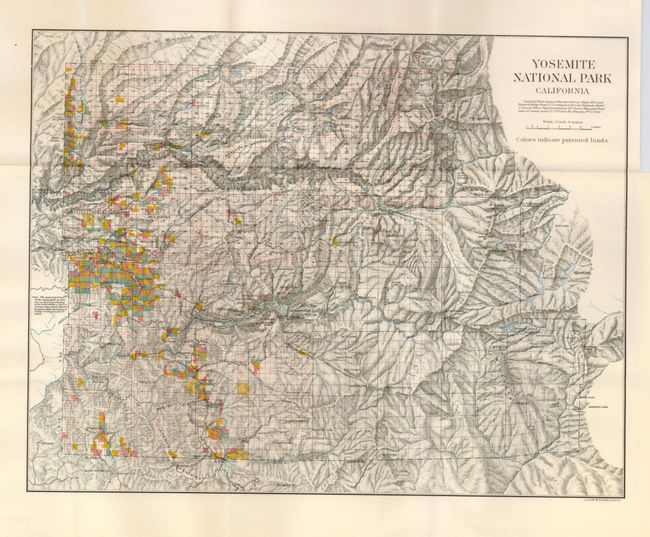
2) Yosemite National Park California. "Colors indicate patented lands." Bien, New York, 1899, (13.8 x 10.6"), printed color. Beautiful stone lithographed map has fine color overprinting to indicate patented lands. It extends to Deadman's Pass in the east; locates White Wolf, Bald Mountain, and various high mountain lakes to the east. Yosemite Valley is at the center with rock formations named.
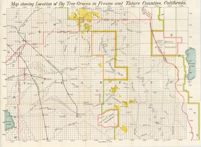
3) Map Showing Location of Big Tree Groves in Fresno and Tulare Counties, California. E.H. Stuck, Washington, 1900, (36.5 x 25"), printed color. Centered on Sequoia National Park the map details the groves throughout the region. It extends to include Selma and part of Tulare Lake in the west and Mount Whitney Military Reservation in the east. There is excellent detail of towns and villages, mining camps, watershed, and more.
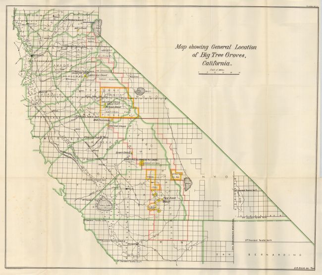
4) Map Showing General Location of Big Tree Groves, California. E.H. Stuck, Washington, 1900, (26.5 x 22.3"), printed color. This map extends from the Marysville/Yuba City area south to Bakersfield. The Big Tree groves are highlighted with yellow overprinting. Locates at least sixteen groves including Dinky, Sequoia, Tule River, Fresno, Merced, Tuolumne, Calaveras, Stanislaus, and the North groves. Other entities which contain groves are also shown: Mt. Whitney Military Reserve, Tule River Indian River, etc. A few light spots at lower left in blank area.
References:
Condition: A+
All folding as issued and fine.