Subject: California
Period: 1879 (dated)
Publication: Cram's Standard American Atlas of the United States
Color: Hand Color
Size:
20 x 28 inches
50.8 x 71.1 cm
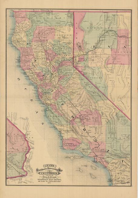
Rare map from the first edition of Cram's most celebrated atlas. This large folding map shows all of California and most of Nevada. The exteme southeastern corner of California is shown on the same scale at lower left. The railroads are named and shown with bold lines. In the central valley they extend north to Redding and Shasta, and to Bodega Bay along the coast. In Southern California the spur lines serve San(ta) Monica and San Pedro. The proposed Southern Pacific line is detailed. Blank verso. The map carries the date of 1879 with a copyright date of 1878. The imprint is Cram's Western Map Depot, 66 Lake St. Chicago, Ills. There was a close relationship between the Cram and Watson firms, who also published from this address. This Lake Street address was the home to Cram's publishing company between 1873 and 1879, thereafter moving to Wabash Avenue.
References: Chicago Map Makers: "George F. Cram and the American Perception of Space" Gerald A. Danzer
Condition: A
Beautiful example with fine original hand coloring and dark impression. On a full sheet with very wide, original margins. A hint of offsetting near lower neatline.