Subject: Western United States
Period: 1846 (dated)
Publication: New Universal Atlas
Color: Hand Color
Size:
12.5 x 15.3 inches
31.8 x 38.9 cm
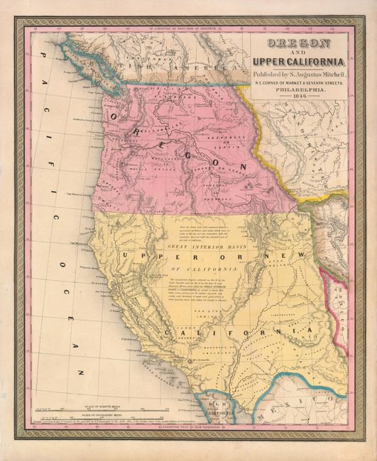
This great map is the first edition in this series of 14 significant maps depicting the rapidly changing American West. Oregon Territory is shown west of the Continental Divide with the northern Boundary of 1846 and the southern Boundary of 1819. Oregon City is shown as the capital. Lewis and Clarke's route, Fremont's Route and the Oregon Trail are noted through wilderness dotted with a few missions, forts and numerous Indian tribes. The area labeled Upper or New California includes present-day California, Nevada, Utah, Arizona, and parts of New Mexico, Colorado and Wyoming. The capital is at Monterey and the region where gold will eventually be found is named Nueva Helvetia. The unexplored interior is labeled and described as the Great Interior Basin of California, which is transversed by the Great Spanish Trail from P. Angelos to Santa Fe. The border with Mexico is substantially south of its true location leaving an expansive U.S. coastline on the Gulf of California.
References:
Condition: A
Great original color with minor toning.