Subject: Colonial Southeast
Period: 1757 (dated)
Publication: Allgemeine Historie der Reisen zu Wasser unde Lande
Color: Black & White
Size:
10 x 7.3 inches
25.4 x 18.5 cm
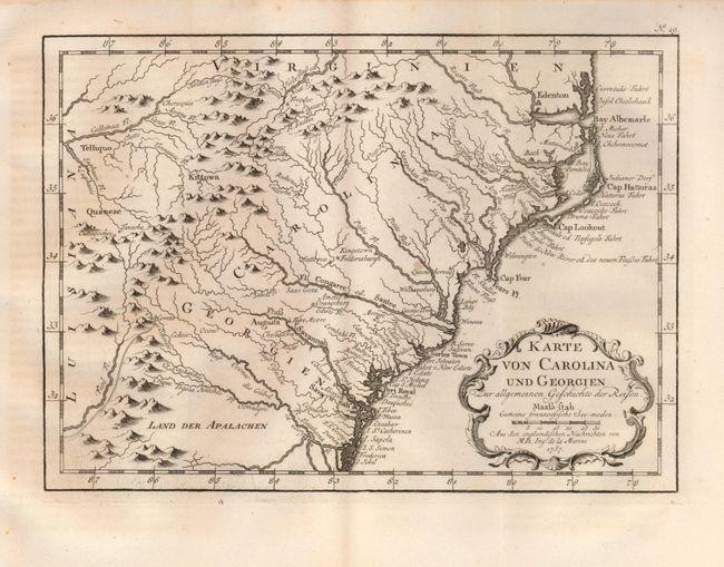
This is from the German edition of Bellin's map for Prevost's Voyages published by Arkstee and Merkus as evidenced by No. 19 outside the top neatline. It is a delicately engraved map of the colonies from Albemarle Sound to the Alatamaha (Altamaha) River. It probably owes its origin to the 1752 map of the region by Emanuel Bowen. English settlements are shown along the coast and Indian villages throughout, including a number west of the Appalachian Mountains. There is more detail in the area west of the Blue Ridge than in other maps of the period. Embellished with a French rococo-style title cartouche.
References: Sellers & van Ee #1385.
Condition: A
Folding as issued. Beautiful, dark impression on a full sheet of hand laid paper with wide margins. One light spot, otherwise fine.