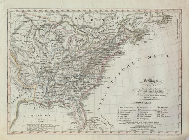
Subject: Eastern United States
Period: 1800 (circa)
Publication: 
Color: Hand Color
Size:
17.5 x 12.5 inches
44.5 x 31.8 cm
This fascinating, scarce map of the young United States shows the original 13 states with the new additions of Vermont, Kentucky, Tennessee, Ohio, and Neu Orleans standing in as present-day Louisiana.   The old Spanish Districts of Howard, St. Louis, Cap Girardeau, Lawrence, and Arcansas are marked in the present-day states of Missouri and Arkansas.  The map provides excellent detail of Indian tribes, towns, settlements and early roads.  Mollo was a Viennese engraver and publisher whose works rarely appear on the market.
References: 
Condition: B+
There are a few scattered tiny worm holes in the map and a couple of edge tears in bottom blank margin.