Subject: Western Hemisphere
Period: 1711-17 (published)
Publication: Atlas geographus, or a Compleat System of Geography
Color: Black & White
Size:
7 x 10.3 inches
17.8 x 26.2 cm
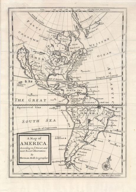
This boldly engraved copper plate map features a huge California as an Island, "Nth. California." New Mexico occupies the majority of the West; Santa Fe is the only city named west of the eastern coast, labeled British Emp. A remnant of Baron Lahontan's mythical geographic is shown in the form of "Rio Longue" with a network of large lakes. The Mississippi River is here called Rio St. Louis with the Missouri labeled Rio St. Philip and the Ohio called the Rio S. Jerome. The S. of Annian, timidly shown, is the last named feature in the northwest with the balance of Canada and Alaska simply and honestly labeled as Parts Unknown. This bright and early impression is from the first edition without pagination.
References: McLaughlin #179-1; Phillips (M) p.107, Phillips (A) No.3477-24.
Condition: A+
Beautiful impression with full margins.