Subject: Asia
Period: 1666 (dated)
Publication: Heylins Cosmographia
Color: Hand Color
Size:
17 x 13.2 inches
43.2 x 33.5 cm
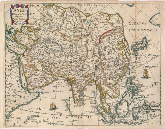
Uncommon map of the continent and East Indies. The outline of the continent follows the Mercator-Hondius model with a great expanse of water between a truncated Asia and North America, and a very elongated Korean peninsula. Many place names graphically depicting the extent of European knowledge throughout Asia and particularly in the Philippines and East Indies. In the interior of China, the Great Wall is graphically depicted, along with an elephant and the fictitious Chiamay Lacus. The coastline of Java that is shown suggests that it is quite a bit larger than it is, and New Guinea and the Moluccas are shown as a confused group of islands. The map is adorned with two sailing ships and a decorative cartouche.
References: cf Yeo #55.
Condition: B+
A dark impression with a bit of light toning. This map has narrow, but still adequate, margins that are larger than most maps from this source.