Subject: Italy
Period: 1698 (circa)
Publication:
Color: Hand Color
Size:
22 x 18 inches
55.9 x 45.7 cm
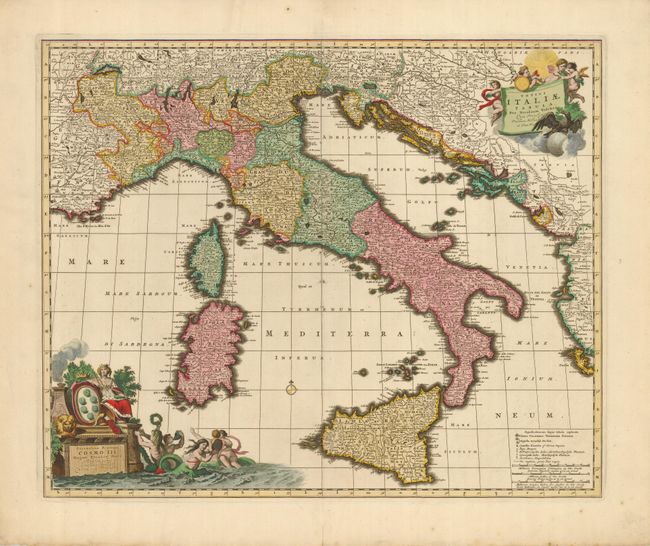
This is a superb map of Italy. It extends to include Savoy, Corsica and Sardinia in the west, and through the Dalmatian coast and Corfu when that region was controlled by the Republic of Venice. The map is filled with information on the cities, towns, universities, and post roads. It is beautifully ornamented with putti surrounding the title cartouche in the upper right corner, and mermaids and Europa surrounding another cartouche in the opposite corner.
References:
Condition: A
Fine impression and exquisite original color. There is a printer's crease on the left side of the map and a fold separation in the bottom margin (closed with archival tape).