Subject: Netherlands
Period: 1680 (circa)
Publication:
Color: Black & White
Size:
21.3 x 18 inches
54.1 x 45.7 cm
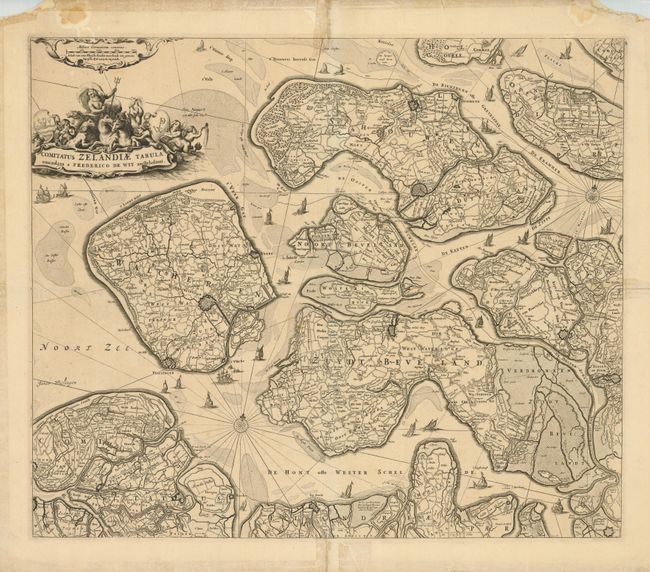
A handsome map of Zeeland detailing the islands of Walcheren, Beveland, Schouwen and Tholen within the Schelde estuary, and Flanders in the south. The map illustrates the topography, roads, town and fortified cities, including Middelburgh, Tolen and Berg op Zoom. Neptune sits astride the aquatic-themed cartouche at top and sailing ships navigate among the islands.
References:
Condition: B
There is masking tape on the paper edges on verso with some extending along the centerfold and a horizontal fold. This has resulted in some small tape stains on the map. The map would benefit from professional removal of the tape, but presents well as is.