Catalog Archive
Auction 125, Lot 49

"Geography. A Map of the World in Three Sections Describing the Polar Regions to the Tropics in which are traced the Tracts of Lord Mulgrave and Captain Cook", Phipps, Constantine John

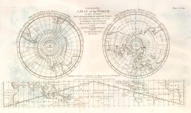
Subject: World - Polar

Period: 1776 (circa)

Publication: Voyage toward the North Pole

Color: Black & White

Size:
16.5 x 9 inches
41.9 x 22.9 cm
Download High Resolution Image
(or just click on image to launch the Zoom viewer)

A finely engraved double polar projection, with a rectangular map of the tropical regions centered on the equator across the bottom. The title continues "towards the North & South Poles and the Torrid Zone or Tropical Regions with the New Discoveries in the South Sea." The southern hemisphere shows Capt. Cook's voyages of 1773, '74, and '75. The northern hemisphere focuses on the 1773 voyages of Captain Phipps, now Lord Mulgrave. Engraved by W. Barker.

References:

Condition: B+

Issued folding, now pressed flat. Small, light area of foxing at lower center and some very light mold stains at upper left. Printed on fine hand laid paper with original margins.

Estimate: $180 - $250

Sold for: $250

Closed on 9/24/2008

Archived