Subject: Britain
Period: 1698 (circa)
Publication: Claudii Ptolemaei's Atlas Tabulae geographicae Orbis Terrarum
Color: Black & White
Size:
15.8 x 13 inches
40.1 x 33 cm
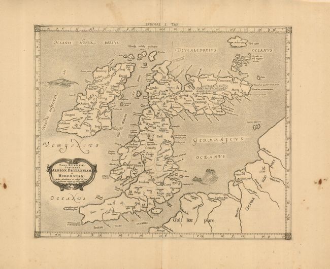
This fine Ptolemaic map of the British Isles shows ancient place names and divisions. Scotland is presented with its distinctive east-west orientation. The map is decorated with a strapwork title cartouche, a sea monster and a fishing scene in the North Sea. Mercator originally published this map in his 1578 edition of Ptolemy's great Geography; this is from the last edition and a crack in the plate at top is evident in this example. Although he is most renowned today for the projection he popularized and for first using the term 'atlas' for a collection of maps, he devoted much of his life to his Ptolemaic maps. The maps were beautifully engraved as nearly as possible to their original form and decorated with strapwork cartouches and interesting vignettes reflecting the customs of the region.
References: Mickwitz & Miekkavaara, (Nordenskiold-2) #234-19; Shirley (BI) #123.
Condition: A
Clean, crisp impression with a couple of stains in the blank margins.