Subject: South America - Southern
Period: 1609 (circa)
Publication: Mercator Atlas
Color: Hand Color
Size:
18 x 13.5 inches
45.7 x 34.3 cm
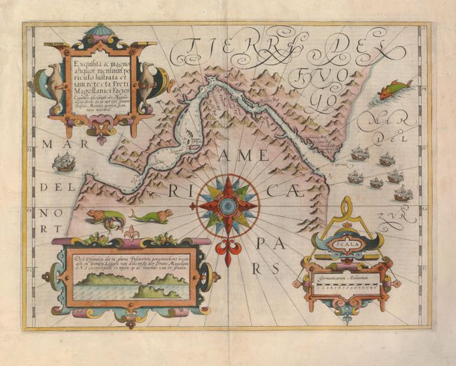
This exquisite map of the Strait of Magellan predates the discovery of the Straits of Le Maire. It details soundings and navigational hazards in this strategic waterway. The geographic details for this map were drawn from Bernardus Joannis Monasteriensis who accompanied the first Dutch expedition to sail through the Strait in 1599-1600. That expedition is portrayed on the map by the fleet of six sailing ships in the Mar del Zur. The map is one of the most beautifully embellished maps of the Mercator Atlas. It is centered on an elaborate compass rose orienting the map with north at the bottom. There are three large strapwork cartouches: penguins flank the title, a navigational compass is incorporated into the distance scale, and an inset with coastal view of the entrance to the strait fills the last cartouche. Whimsical sea lions, a whale and ships complete the composition. Latin text on verso.
References:
Condition: B+
Fine impressions and lovely color. The centerfold has been reinforced on verso and there are a couple of very tiny wormholes in the map.