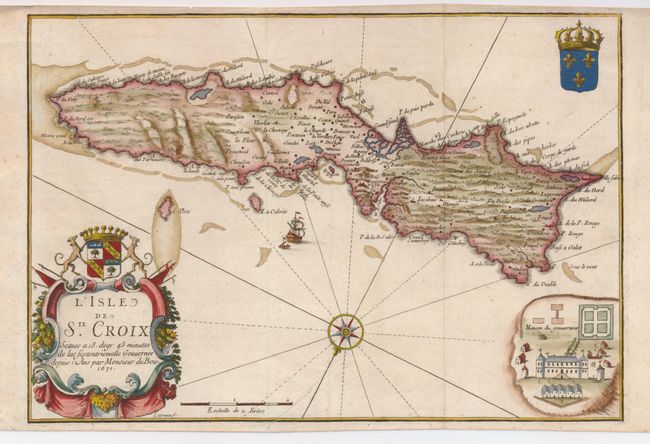
Subject: St. Croix
Period: 1671 (dated)
Publication: Du Tertre's Histoire generale des Antilles…
Color: Hand Color
Size:
12.3 x 8.5 inches
31.2 x 21.6 cm
This scarce map of St. Croix, U.S. Virgin Islands, is filled with detail along the coastline and in the western part, while the eastern part of the island is lacking in any settlement. The map is oriented by a compass rose with north to the bottom. It is richly embellished with a large title cartouche, coats of arms, a sailing ship and also includes a pictorial inset of the governor's house (Maison du gouverneur). This map reflects the island during one of its most prosperous periods when it was managed by Governor DuBois of the French West Indian Company.
References: Phillips (M) p. 757.
Condition: B+
Nice impression and attractive color. There is a repaired, 2" tear into the bottom of map near the compass rose.