Catalog Archive
Auction 125, Lot 358

"A New Map of the West Indies for the History of the British Colonies", Edwards, Bryan
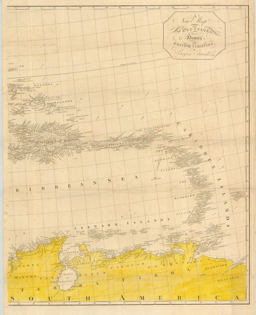
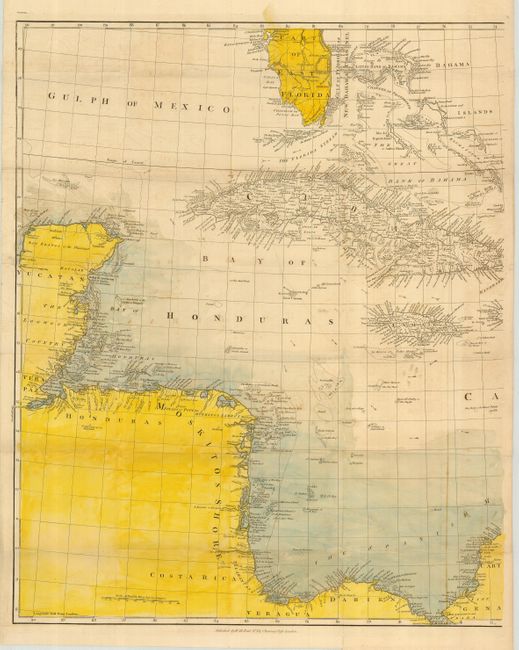
Subject: Caribbean

Period: 1818 (published)

Publication: The History, Civil and Commercial, of the British Colonies in. the West Indies

Color: Hand Color

Size:
43.5 x 27 inches
110.5 x 68.6 cm
Download High Resolution Image
(or just click on image to launch the Zoom viewer)

This an unusual map made by Bryan Edwards, a Jamaican planter and politician, for his publication describing the West Indies. The map is printed on two sheets, and it shows in extensive detail the area from the southern tip of Florida through the Yucatan and Honduran coasts (here called Moskitos Shore) to the northern coast of South America. Each of the islands is shown in minute detail. Published by H. Reid, No. 32 Charing Cross. Dated 1793, this edition was published in 1818. The sheets are not joined, as issued. The overall size if joined is given; each sheet is approximately 22" x 27".

References:

Condition: B+

On thick paper with full coloring and strong, dark impression. A little offsetting else very good.

Estimate: $600 - $800

Sold for: $425

Closed on 9/24/2008

Archived