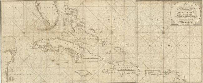
Subject: Caribbean
Period: 1797 (dated)
Publication: A Marine Atlas
Color: Black & White
Size:
73.5 x 30.8 inches
186.7 x 78.2 cm
This is an incredible, large-scale chart covering from the Gulf of Florida (Tampa Bay) through the Bahamas and Caribbean Islands as far south as Antigua. The chart is filled with excellent detail and soundings, particularly in the Florida Keys and Bahamas. The chart is printed on three joined sheets, as issued. At the end of the 18th century Britain played a leading role in chart making and William Heather was among the most prominent cartographers of the period. He succeeded Mount and Page and then established a Naval Academy and the Naval Warehouse, which provided nautical instruments, charts and instructional texts on navigation.
References:
Condition: B
The map is in remarkable condition considering it size and purpose. There are some repaired fold intersections and repairs in margins and the map borders, but there are no significant flaws.