Catalog Archive
Auction 125, Lot 347

"Carte du Golphe du Mexique et des Isles de l'Amerique", Bellin, Jacques Nicolas

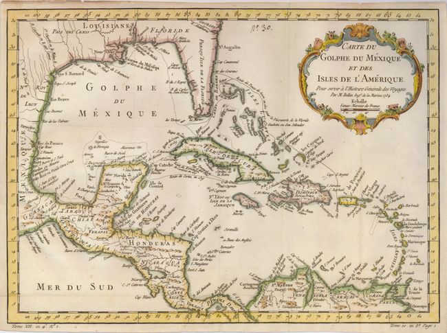
Subject: Gulf of Mexico and Caribbean

Period: 1754 (dated)

Publication: La Harpe's Abrege de l'Histoire Generale des Voyages

Color: Hand Color

Size:
14.8 x 10.8 inches
37.6 x 27.4 cm
Download High Resolution Image
(or just click on image to launch the Zoom viewer)

Attractive map of the islands of the Caribbean that includes those parts of the United States and Mexico bordering the Gulf of Mexico, Central America, and the northern coastline of South America. Routes of several explorers are shown, including Cortez, Ponce de Leon, and Hernandez de Cordova, along with many coastal place names. A delicately engraved rococo-style title cartouche fills the upper right.

References: Seller's & Van Ee #1683.

Condition: A

Issued folding, now flattened. Very nice impression and coloring with two large watermarks in hand laid paper.

Estimate: $275 - $325

Sold for: $200

Closed on 9/24/2008

Archived